About Us
We provide fast, affordable, AI-driven soil analysis using the farm’s GPS coordinates only to deliver tailored fertiliser blend recommendations and periodic precision ‘fertigation’ reports, reducing water+fertiliser waste while improving yields, soil health, and sustainability at scale.
Our unique AI model combines soil data and Earth observation data to assist farmers in finding the most effective fertilizer blends for their soil conditions, making the process quick, cost-effective, and scalable. With only a farm's GPS coordinates, this data-driven strategy allows for optimized resource utilization (water and fertiliser), resulting in improved soil health and increased crop yields per hectare.
Over a virtual call or physical meeting, we can discuss the reliability and consistency of our technology and your specific needs. Our service is flexible, localized, hands-on, and offers multiple channels for access, and more productivity.
JOIN EARLY ACCESS PROGRAM
Portfolio Satellites
Spatial Resolution
Cost-effective than Others

-
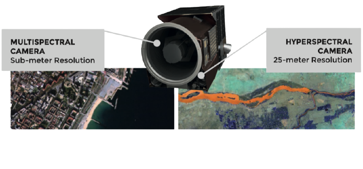
Multispectral camera
High-resolution 99cm GSD on all bands and 70cm (0.7m) Super Resolution. Up to 4 revisit of any point of interest
-
Hyperspectral sensor
Imagery from 29 bands at 25-m resolution
-
Video capturing
Up to 60 sec acquisition of ground event
-
Capture mode
Off-nadir capturing with +/-25 angles. Capture modes include spotlight, tiles, stripes and line-following/oblique.
Case Study
Soil quality contributes approximately 45% to yield potential, making the optimization of nutrient and water use crucial for sustainable and profitable farming.